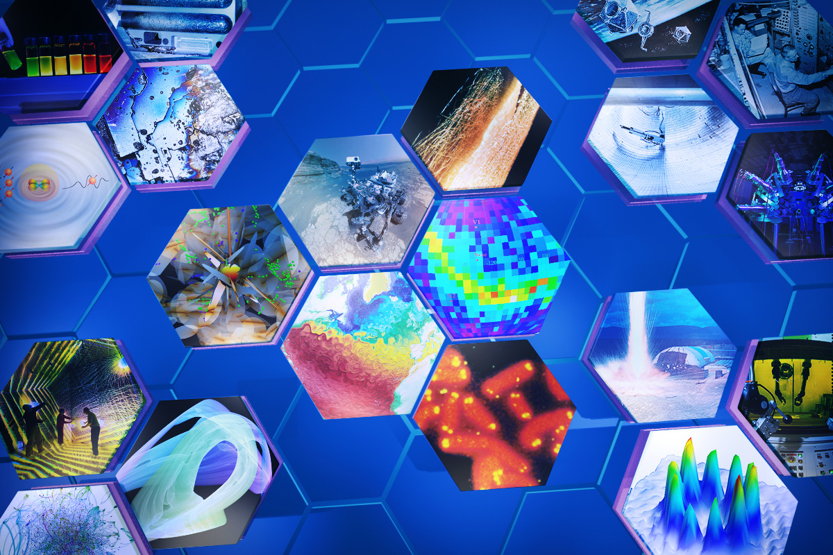
The Transparent Earth
Los Alamos is turning its deep expertise in Earth’s subsurface—and new advances in AI—into a clearer picture of the planet beneath our feet.
- Kyle Dickman, Science Writer
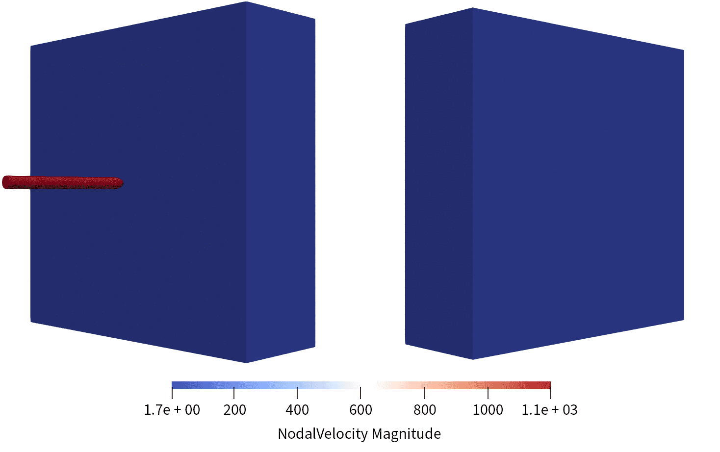
In the fall of 2025, a presentation was given to the U.S. Secretary of Energy and a handful of defense officials on some of Los Alamos National Laboratory's latest computing research. One slide showed a model of a projectile striking a block of material and cracks spiderwebbing out from the impact. “Bunker busting,” says Hari Viswanathan, a geologist at Los Alamos whose work was being presented. “Our goal was to predict how materials fracture before they fail.”
The work looked and sounded like weapons science. It was. Yet the models that guided the design of bunker-busting projectiles were born out of decades of Lab research into the Earth’s subsurface.
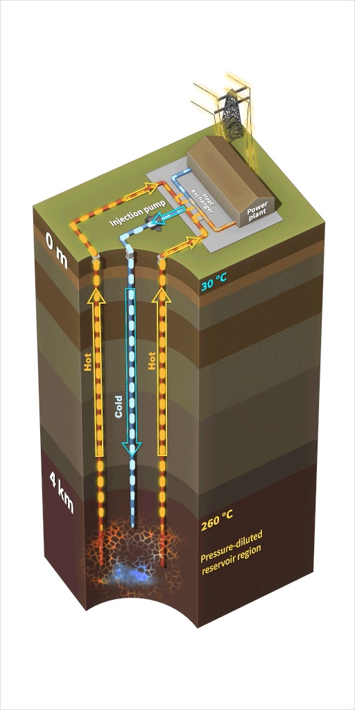
By the 1970s, a pair of global oil shortages drove Los Alamos scientists to begin looking for energy alternatives in the subsurface. For one source, they turned to the hot rock beneath the 11,000-foot volcanic peaks of the nearby Jemez Mountains. At a site called Fenton Hill, they drilled two wells—each nearly three miles deep—into granite and rhyolite heated by ancient volcanic activity to about 250–300 °C. Cold water was pumped into one, where it cracked the rock and formed a network of tiny fractures. From the second well, steam billowed to the surface, spinning a turbine.
At the time, it was known that geothermal electricity generation was feasible. But the Lab scientists, led by the geologist Donald W. Brown, showed at Fenton Hill that hot, dry rock could be artificially fractured and that by circulating water through that cracked rock, it was possible to create geothermal reservoirs where none existed before. That work paved the way for ongoing Department of Energy projects like the Frontier Observatory for Research in Geothermal Energy in Milford, Utah, where the agency hopes to show that geothermal power is both commercially scalable and viable at many sites in the continental United States.
“You don’t get to directly image the subsurface. The best you can do is use geophysical data to get an inkling of what’s going on.”
Whether the goal is to contain an explosion, store waste, or harvest heat, success depends on understanding the physics of how rock breaks—or doesn’t—and moves. “All subsurface models, no matter what question they’re helping answer, require the same physics,” Viswanathan says. From the 1980s into the 2020s, that knowledge of fluid flow, fracture mechanics, and the ability to predict what could not be seen fed the Lab’s growth into new programs: nuclear-waste disposal, earthquake prediction, carbon sequestration, or hydraulic fracturing. Yet our understanding of the subsurface remains incomplete.
“You don’t get to directly image the subsurface,” Viswanathan says. “The best you can do is use geophysical data to get an inkling of what’s going on.” To decode those faint signals, Los Alamos spent decades refining its instruments. Laboratory researchers developed and refined acoustic probes that detect rock strain and used x-ray and neutron experiments at the Los Alamos Neutron Science Center (LANSCE) to watch fractures form under pressure. Insights from those experiments fed high-performance simulations that reproduce the physics of the shallow Earth. Now, the Lab is turning to artificial intelligence (AI) to unite it all.
“The physics never change. The questions do. The applications shift with the moment, but the science is always rooted in the same fundamentals.”
Viswanathan compares the way that AI processes diverse information sources to the way that senses emerge and are refined in nature. “It’s like a dog’s nose,” he says. “Each of the many receptors in it isn’t extraordinary, but together, they make sense of a world we can’t see.” That pattern-recognition ability is being put to use in a project led by geoscientist Dan O’Malley that is called Transparent Earth. Building on seven decades of the Lab’s subsurface research, the project promises to enable the discovery of new energy sources and deposits of critical minerals, and it could even support global nuclear nonproliferation. The idea is to teach AI to visualize the underground environment by feeding it essentially every available measurement of the subsurface—seismic tremors, magnetic maps, satellite images, drill-core chemistry, even text from decades of field reports by the U.S. Geological Survey. The model learns by combining imperfect signals into a clear picture.
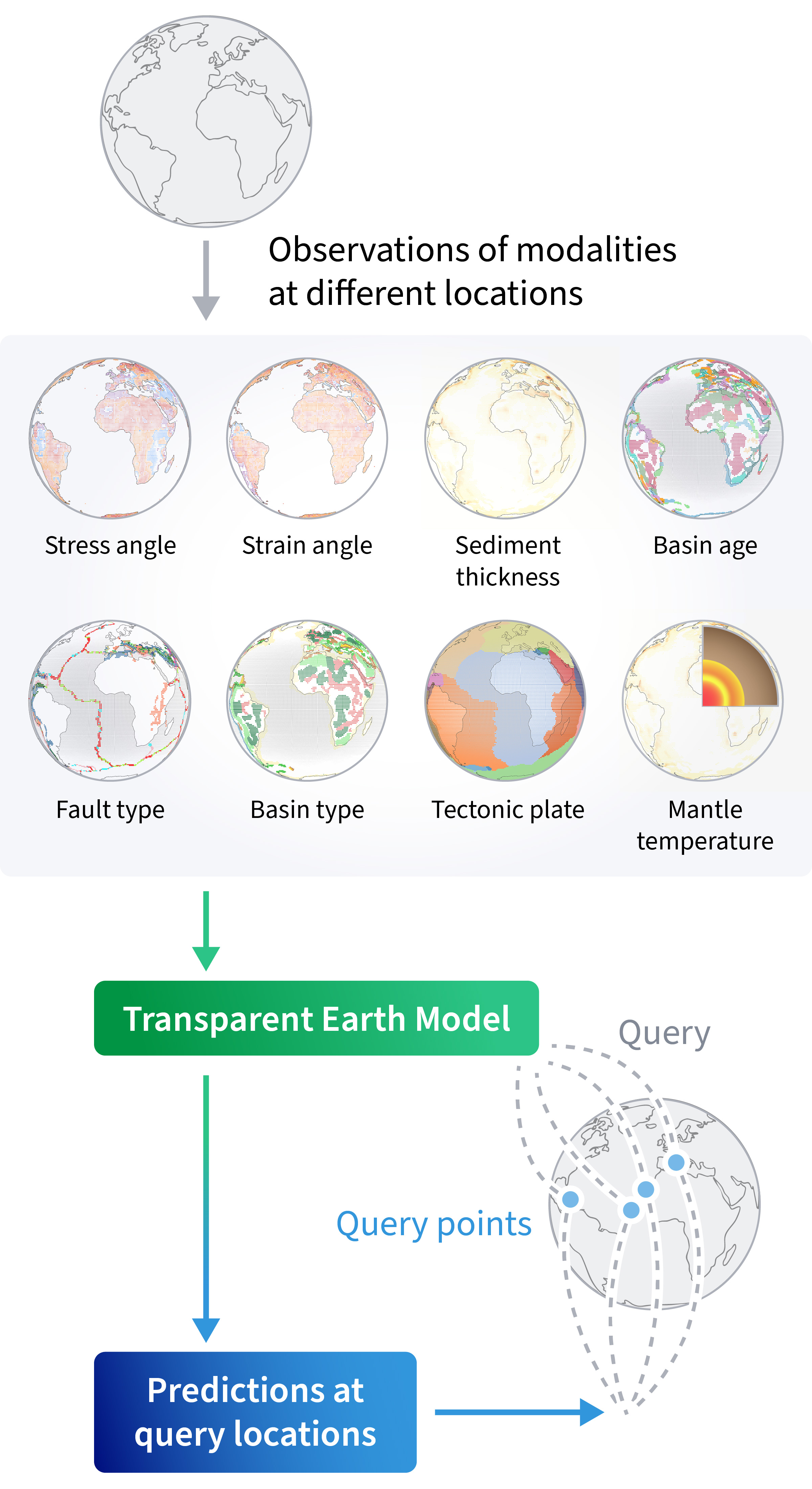
Transparent Earth visualizes those inputs. It fuses the signals into probabilistic maps that predict what lies beneath: where fractures might open during fracking or geothermal exploration, where heat might flow, where critical minerals might hide, and the subsurface temperature in different areas of the continental United States. In the past, those clues would have remained buried in separate datasets.
Viswanathan and O’Malley hope that, with the help of AI, they can fuse decades of scientific data and Lab expertise into a digital twin of the planet’s crust—a physics-informed, AI-powered model of the Earth’s hidden systems. “The physics never change,” says Viswanathan. “The questions do. The applications shift with the moment, but the science is always rooted in the same fundamentals.”
People also ask:
- How deep can we drill into the Earth? The deepest hole ever drilled—the Kola Superdeep Borehole in Russia—reached about 7.6 miles (12.3 kilometers) into the Earth’s crust. Most scientific and energy wells, though, extend only two to three miles down, where temperatures and pressures push the limits of drilling technology. In the 1970s, Los Alamos scientists in northern New Mexico helped redefine what “deep” meant by proving that geothermal reservoirs could be engineered where none naturally existed. That experiment—the world’s first successful demonstration of hot-dry-rock geothermal energy—pioneered new drilling, fracturing, and modeling techniques that underpin today’s enhanced-geothermal and deep-subsurface projects. The same physics and sensing technologies that made that early work possible now guide both energy innovation and national security research, from monitoring underground tests to understanding the stability of the Earth itself.
- How do scientists know what’s inside the Earth? Scientists can’t look directly into the Earth, but they can read the signals it sends. Seismic waves from earthquakes travel at different speeds through rock, metal, and liquid, revealing the planet’s layered interior. Instruments on the surface measure magnetic and gravitational fields while satellites and boreholes add more detail. Over the decades, those tools have evolved from mechanical sensors to high-performance simulations that model how heat, pressure, and fluids move underground. At Los Alamos National Laboratory, that search for understanding has stretched from modeling underground explosions during the nuclear era to developing ways to “see” through rock using physics and data. Today, those decades of research are being applied toward a new artificial intelligence–driven project called Transparent Earth—a digital twin of the planet’s crust that fuses seismic, magnetic, and chemical data to visualize the world beneath our feet in unprecedented detail.