
Building Locator

Maps

Los Alamos Townsite
Map of the Los Alamos townsite and surrounding areas including White Rock
Read More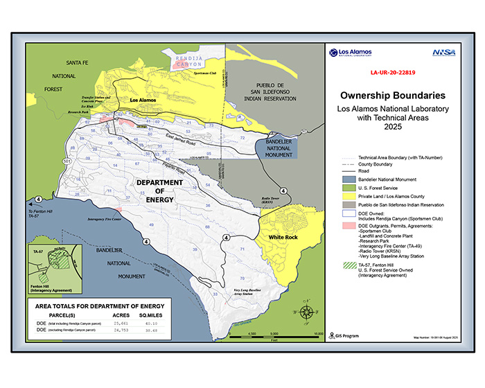
LANL Ownership Boundaries
LANL and surrounding land owners.
Read More
Technical Areas
Generalized map showing all technical areas in Los Alamos and White Rock
Read More
Technical Area 3
Overview of map of the area covered by Technical Area 3 (TA-3), the main administrative area of the Lab, including the National Security Sciences Building.
Read More
TA-3 and Los Alamos
This map shows a portion of TA-3 in relation to the city of Los Alamos
Read More
TA-3 Research Park (parking)
Map of the Research Park at TA-3 with parking highlighted
Read More
Technical Area 16
Map of TA-16 and the surrounding area
Read More
Technical Area 35
Map of TA-35 which includes the The National High Magnetic Field Laboratory's Pulsed Field Facility
Read More