|
|
|
|
|
|
|
||||||||||||||||||
|
||||||||||||||||||
|
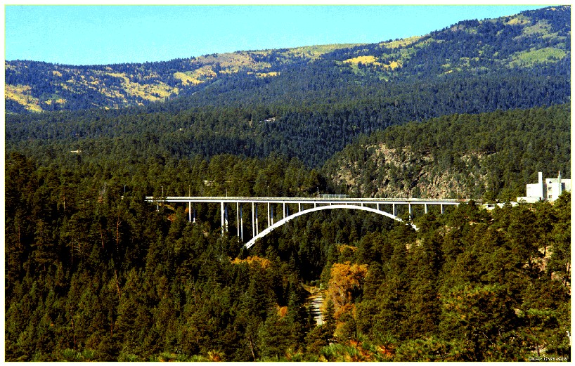
The picturesque and mountainous town of Los Alamos is a unique place to work, live, and play.
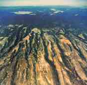 Los Alamos sits on the Pajarito Plateau, a
consolidated mass of volcanic tuff from the Valles and Toledo
eruptions (1.4 to 1.1 million years ago). The town-site is built on
a series of fingers of land (locally referred to as mesas) separated
by deep canyons. The canyons result from water runoff from the
Sierra de los Valles (a branch of the Jemez Mountains, one of the
southernmost extensions of the Rockies) which border the town, and
range up to several hundred feet deep. Most of the town is located
on the top of the mesas, at an elevation around 7,500 feet above sea
level. In addition, the community of White Rock sits at the base of
the mesas, around 7000 feet.
Los Alamos sits on the Pajarito Plateau, a
consolidated mass of volcanic tuff from the Valles and Toledo
eruptions (1.4 to 1.1 million years ago). The town-site is built on
a series of fingers of land (locally referred to as mesas) separated
by deep canyons. The canyons result from water runoff from the
Sierra de los Valles (a branch of the Jemez Mountains, one of the
southernmost extensions of the Rockies) which border the town, and
range up to several hundred feet deep. Most of the town is located
on the top of the mesas, at an elevation around 7,500 feet above sea
level. In addition, the community of White Rock sits at the base of
the mesas, around 7000 feet.
 In general terms, Los Alamos has a temperate mountain climate with
four distinct seasons. Spring tends to be windy and dry. However,
the winds are usually light, averaging from 2 mi/h to 8 mi/h. Summer
begins with warm, often dry, conditions in June, followed by a
2-month rainy season. During this "monsoon" season (referred to as
monsoons by residents, but really just predictable afternoon
rainstorms), roughly 35% of the annual 18 inches of precipitation
falls, often in lightening storms. Los Alamos experiences 61
thunderstorm days a year, twice the national average and second in
frequency only to the southeastern United States. On the other hand,
over 300 days a year - 80% of all daytime hours - are clear, sunny
days. In the autumn there is a return to drier and cooler weather.
And in winter, mid-latitude storms drop far enough south to keep the
ground covered with snow for a couple of months. Snow, like rain, in
Los Alamos is highly variable, but tends to average 28 inches
annually. Temperatures in January (the coldest month) range from
17° F - 40° F with an average humidity of 55%; the hottest
month is July, with temperatures from 55° F - 81° F, and
humidity around 40%. The hottest day on record is 95° F; the
coldest, -18° F.
(Current
conditions according to The Weather Channel).
In general terms, Los Alamos has a temperate mountain climate with
four distinct seasons. Spring tends to be windy and dry. However,
the winds are usually light, averaging from 2 mi/h to 8 mi/h. Summer
begins with warm, often dry, conditions in June, followed by a
2-month rainy season. During this "monsoon" season (referred to as
monsoons by residents, but really just predictable afternoon
rainstorms), roughly 35% of the annual 18 inches of precipitation
falls, often in lightening storms. Los Alamos experiences 61
thunderstorm days a year, twice the national average and second in
frequency only to the southeastern United States. On the other hand,
over 300 days a year - 80% of all daytime hours - are clear, sunny
days. In the autumn there is a return to drier and cooler weather.
And in winter, mid-latitude storms drop far enough south to keep the
ground covered with snow for a couple of months. Snow, like rain, in
Los Alamos is highly variable, but tends to average 28 inches
annually. Temperatures in January (the coldest month) range from
17° F - 40° F with an average humidity of 55%; the hottest
month is July, with temperatures from 55° F - 81° F, and
humidity around 40%. The hottest day on record is 95° F; the
coldest, -18° F.
(Current
conditions according to The Weather Channel).
 Proud Past, Dynamic Future is the slogan of Los Alamos County, as it
reflects the role Los Alamos has always seen for itself. The town
started out as a boys school run by Ashley Pond, but was taken over
by the US government during WWII for the express purpose of
designing and building a nuclear weapon. A quick-and-dirty townsite
was thrown together for this effort; the army assumed that Los
Alamos would be abandoned after the war years. However, the
laboratory (and thus the people) stayed around, although it wasn't
until 1950 that the fences surrounding the town were taken down, and
Los Alamos became open to the public (to much complaining from the
residents at the time!). The county of Los Alamos finally
incorporated in 1968. Since the beginning, Los Alamos has remained
much the same size, and kept much of its unique and independent
atmosphere.
Proud Past, Dynamic Future is the slogan of Los Alamos County, as it
reflects the role Los Alamos has always seen for itself. The town
started out as a boys school run by Ashley Pond, but was taken over
by the US government during WWII for the express purpose of
designing and building a nuclear weapon. A quick-and-dirty townsite
was thrown together for this effort; the army assumed that Los
Alamos would be abandoned after the war years. However, the
laboratory (and thus the people) stayed around, although it wasn't
until 1950 that the fences surrounding the town were taken down, and
Los Alamos became open to the public (to much complaining from the
residents at the time!). The county of Los Alamos finally
incorporated in 1968. Since the beginning, Los Alamos has remained
much the same size, and kept much of its unique and independent
atmosphere.
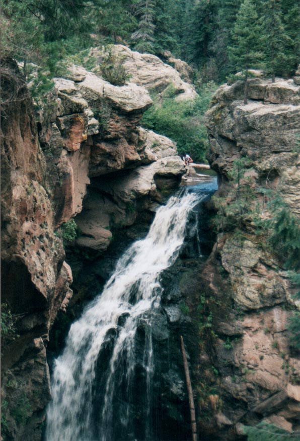 Los Alamos has an ideal climate for outdoor recreation, with ample
hiking and camping opportunities all year. During the warmer months,
there are several hiking, biking, and horse riding trails, as well
as developed and undeveloped campgrounds scattered around, including
at Abiquiu Reservoir, a large lake an hour's drive from town. During
winter, Los Alamos sports New Mexico's only outdoor ice-skating
arena, and the Pajarito Ski
Area is only 6 miles from the town. (and only 4 miles from LANL
at its closest point -- lab employees have been known to go skiing
on their lunch breaks...)
Los Alamos has an ideal climate for outdoor recreation, with ample
hiking and camping opportunities all year. During the warmer months,
there are several hiking, biking, and horse riding trails, as well
as developed and undeveloped campgrounds scattered around, including
at Abiquiu Reservoir, a large lake an hour's drive from town. During
winter, Los Alamos sports New Mexico's only outdoor ice-skating
arena, and the Pajarito Ski
Area is only 6 miles from the town. (and only 4 miles from LANL
at its closest point -- lab employees have been known to go skiing
on their lunch breaks...)
In addition, Los Alamos has an active artistic society, with its own Symphony Orchestra and Little Theatre, and several public concerts and art shows throughout the year. The Fuller Lodge Art Center is a free, public showcase of largely local and regional artists, and gives public workshops and seminars throughout the year.
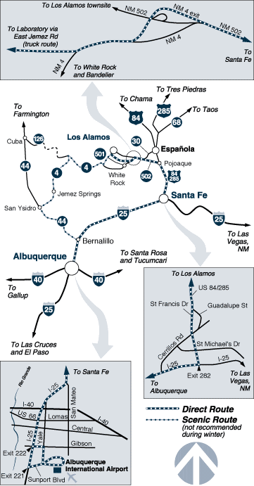 Los Alamos is located about 25 miles north-west of Santa Fe, New Mexico. The easiest
way to get to Los Alamos from out of state is to fly into
Albuquerque, and drive to Santa Fe on I-25. From Santa Fe, take NM
Highway 84/285 North to Pojoaque, and then NM 502 from Pojoaque to
Los Alamos. (see a
map) Alternatively, you could take NM 44 to San Ysidro and NM 4
to Los Alamos. This drive through the Jemez Mountains is a bit more
scenic, but also takes about a half-hour longer (for a total trip of
two hours).
Los Alamos is located about 25 miles north-west of Santa Fe, New Mexico. The easiest
way to get to Los Alamos from out of state is to fly into
Albuquerque, and drive to Santa Fe on I-25. From Santa Fe, take NM
Highway 84/285 North to Pojoaque, and then NM 502 from Pojoaque to
Los Alamos. (see a
map) Alternatively, you could take NM 44 to San Ysidro and NM 4
to Los Alamos. This drive through the Jemez Mountains is a bit more
scenic, but also takes about a half-hour longer (for a total trip of
two hours).
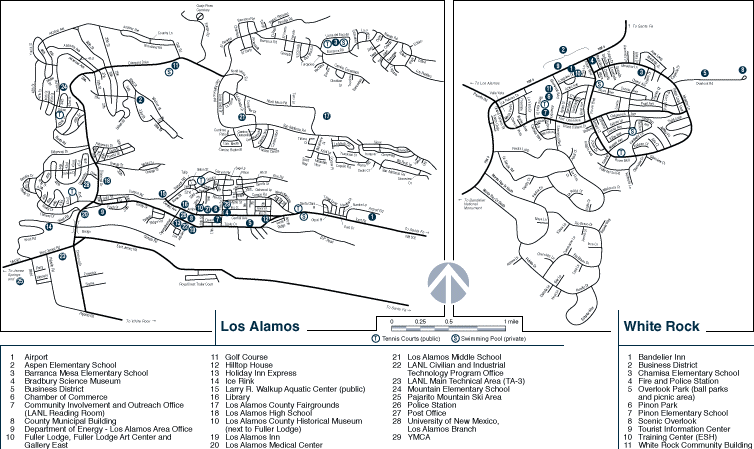
Los Alamos and its satellite community of White Rock can be a bit confusing to get around in at first, but with a good street map and some practice, navigating the town becomes easy. In addition, LANL's official Visitor's Guide is available as a PDF.
|
|
Operated by the
University of California for the National Nuclear Security Administration, of the US Department of Energy. Copyright © 2001 UC | Disclaimer/Privacy |
| NOTICE: Information from this server resides on a computer system funded by the U.S. Department of Energy. Anyone using this system consents to monitoring of this use by system or security personnel. For complete conditions of use see Disclaimer/Privacy. | |