Mapping the Caja del Rio plateau
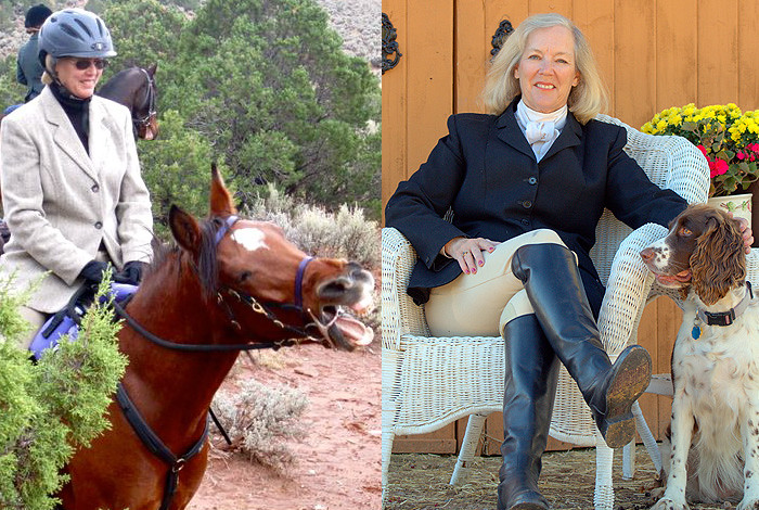
Equestrian Deirdre Monroe worked for the Weapon Systems Engineering Division’s Detonator Technology group. She retired in May 2016.
In 1997, Deirdre Monroe, then a Lab employee, rode her horse into the Santa Fe National Forest’s 67,000-acre Caja del Rio Unit for the first time. She did not have a good sense of where to go or what she would find in this remote, isolated, and unknown “Wild West” region.
As she began to explore the Caja more frequently, Monroe purchased U.S. Geological Survey maps of the area, but the maps turned out to be not very accurate or complete. “I was pulling out one map and then the other, folding them on the border to try to match up the contours,” she remembers. “The whole process was just exasperating.”
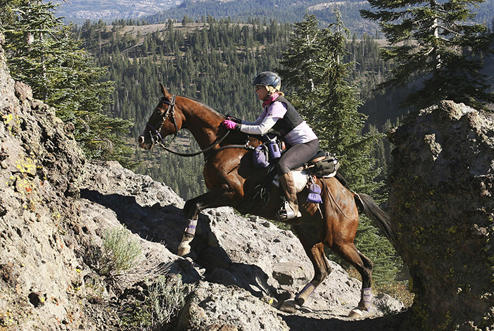
Deirdre Monroe and her Arabian gelding Buddy during one of their competitions, the 100-mile Western States Trail Ride (Tevis Cup) in California. Photo courtesy of Hughes Photography.
Being an engineer, Monroe bought a Global Positioning System (GPS) device. But she also wanted another method for figuring out where she was, how far she had ridden, and just what connected with what. So she bought topography computer software.
“Now I could record our rides with my GPS,” Monroe says, “dump the data into my topo system at night and occasionally have the results printed at a Santa Fe travel store for personal use.”
Maps and trails for others
By 2004, Monroe realized that a detailed map of the Caja was needed not just for equestrians like herself but other users as well. She began the process of refining her personal maps by returning to the Caja to verify GPS points and look for trails she might have missed before. She also met with Forest Service officials to further coordinate her project.
“My first professional map, which covered only the northern Caja, was published in 2005,” Monroe says. With that map as a foundation, Monroe turned her attention to the Caja’s overall lack of trail amenities—and its trash problem.
“Illegal dumps marred the Caja’s beauty,” Monroe explains. “People had used the Caja for target practice or as a partying place with left-behind beer cans and whiskey bottles. I thought that if we could attract more respectful and environmentally conscious outdoor users, they might edge out the troublemakers.”
And so Monroe wrote a grant application in collaboration with the Forest Service.
“The grant required a five-percent cash match for a $100,000 project,” Monroe remembers. “In 2007 the grant was approved, with the American Endurance Riding Conference writing the check for $5,000.”
The funds were used to install gravel parking lots, toilet facilities, map kiosks, trail signs and horse-friendly gates in the Caja. Volunteers hauled away mattresses, old TVs, and many bags of smaller trash.
“Looking back, I am touched that a small personal project, and one largely based on curiosity, has created so much enthusiasm and assistance from others,” Monroe says. “People I met along the way are now some of my best and dearest friends.”
Read a longer version of this profile here.
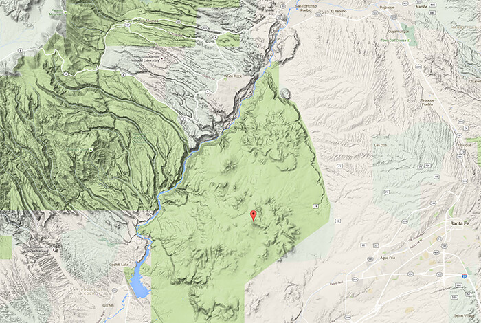
The Caja del Rio Plateau is located west of Santa Fe and southeast of Los Alamos.

